Turning data into predictive models for decision making from data-poor to data-rich stages
Range of clients
4DGeo's consulting services are for all clients whose success relies on good subsurface geological models - maps, cross-sections, and 3D models.
Clients range from junior mineral exploration companies to international mining houses, form geothermal exploration and development projects to oil, gas and hydrogen exploration and production, and those involved in underground storage and sequestration. Clients also include geological surveys.
I am involved in university teaching and academic projects when I can.
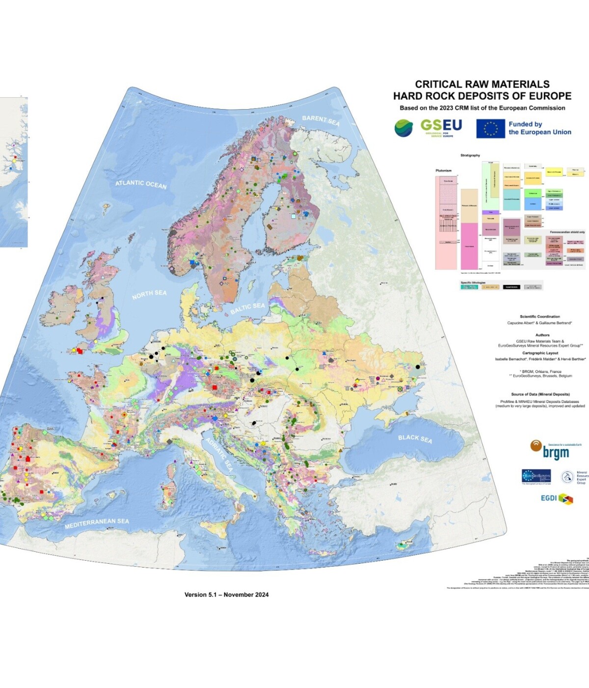
Map: Albert, C., & Bertrand, G. (2025). Map of Critical Raw Materials hard rock deposits of Europe 2024. Zenodo. https://doi.org/10.5281/zenodo.15222112
Delivering geometrically valid and geologically sound models
Whether you have just started exploring, or need to make decisions on a mine life extension, a good understanding of the structural history and the present-day fault framework is fundamental at any stage.
4DGeo offers structural geological contributions for all stages. From a ground-truthed structural geological map and an understanding of the tectonic context for starting projects, to series of cross sections at drilling stage to investigate the key structures of the system, to a full blown 3D geological framework model for identifying 3D fault shapes and connectivity, or fault block sizes and shapes, or volumes with a high permeability and/or a high dilation potential.
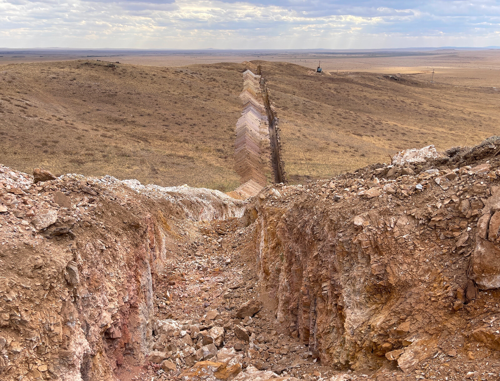
''Armelle helped us to understand this complex fold and thrust belt in Central Kazachstan by mapping the relationship between structures and alteration. With knowledge of the orientation of the main thrusts we optimized the exploration drilling program''.
Mineral exploration & mining sector deliverables include:
- Integration of surface and subsurface datasets, scaled and georeferenced in 3D digital space
- Predictive structural framework and kinematic models, understanding of structural control on mineralization, for exploration targeting
- Fault and fracture connectivity models to inform hydrogeology and geotechnical studies
- Internally consistent and valid geological (seismic) interpretation, maps, sections, 3D models, concepts and alternative scenarios, field checks
- Geologically consistent predictions on mineralization volume, extent and continuity, ore-body offsets
- Better informed brownfield exploration by linking structural control to regional kinematics
- Structural logging of (oriented) drill core, knowing what to log and why
- Structural field mapping, digital data collection (MoveClino)
- Technology transfer, training and mentoring
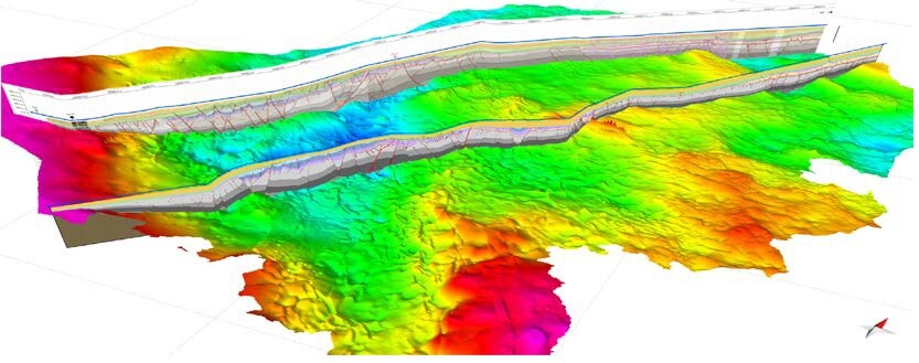
Seismic lines across The Netherlands, improving the understanding of potential for ultra-deep geothermal systems in the Dutch subsurface, part of the SCAN project: www.nlog.nl/sites/default/files/2019-09/scan_dinantian_burial_and_structuration_report.pdf
Geothermal energy sector deliverables include
- Internally consistent and valid geological 2D and 3D geological models of present-day geometry, including stratigraphic layers.
- Integration with geophysical datasets, magnetic, gravity and both reflection and passive seismic.
- Structural interpretation of 2D and 3D seismic data sets in 3D structural context.
- Fault block compartment interpretation, fault-juxtaposition maps.
- Palaeo-reconstructions, basin geometries, faceis distribution, burial depth through time.
- Ranked optimum drainage points, fault/ fracture fluid pathways and overall connectivity for target selection optimisation.